| Path# | Map# | Color | Fit | Difficulty | Season | Comments | LENGTH |
|---|---|---|---|---|---|---|---|
|
1630
|
1 |
|
usual |
Always
|
---
|
4.2 Km
|
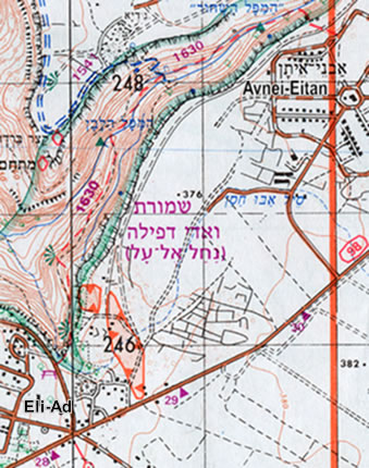
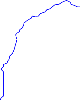
On the Golan Heights, road 98, between kilometers 28-29 turn to Eli-Ad settlement. Outside the entrance to the settlement is a recreation and parking area.
From there follow the red marks to the north-west. The trail ends at Avnei-Eitan settlement.
From there follow the red marks to the north-west. The trail ends at Avnei-Eitan settlement.
updated: 28.02.09 9:25 © Kalmanovitz Bros. 2002