| Path# | Map# | Color | Fit | Difficulty | Season | Comments | Duration |
|---|---|---|---|---|---|---|---|
|
2283
|
2
|
|
usual |
Always
|
---
|
3-6 hours
|
The trail is north to Galilee Lake (Kineret).
This is a dirt road accessible to all types of cars during almost all seasons.
The trail\road begins on road 91 between Gadot junction and Benot-Yaakov Bridge. It ends near Karkum village, road 8277.
Until 1967 (Six Days War) this segment of Jordan River had formed the border between Syria and Israel.
It is recommended that, where possible, to leave the car and access the 2281 (black) trail, by foot, which is closer to the water (Jordan River). Along the 2281 trail are camping places.
Along the road you can see the place where, before 1967, Israel had tried to build the National Aqueduct, but the Syrians destroyed the equipment.
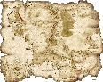
To see all the map and trail use the Scroll Bar on the right.
This is a dirt road accessible to all types of cars during almost all seasons.
The trail\road begins on road 91 between Gadot junction and Benot-Yaakov Bridge. It ends near Karkum village, road 8277.
Until 1967 (Six Days War) this segment of Jordan River had formed the border between Syria and Israel.
It is recommended that, where possible, to leave the car and access the 2281 (black) trail, by foot, which is closer to the water (Jordan River). Along the 2281 trail are camping places.
Along the road you can see the place where, before 1967, Israel had tried to build the National Aqueduct, but the Syrians destroyed the equipment.
To see all the map and trail use the Scroll Bar on the right.


updated: 08.07.07 14:52
© Kalmanovitz Bros. 2002